Friday, August 9, 2013

Mt. Whitney Take Two

Two months ago Anil and I climbed Mt. Whitney, which at 14,505 feet (4,421 m) is the highest peak in the contiguous US. Getting to the Mt. Whitney summit isn't actually that difficult, as it doesn't involve a technical climb, just hiking. Still, not many people reach the summit, defeated either by Whitney's elevation or the length of the hike (it's 22 miles, round trip).

I'm proud to say that not only Anil and I reached the summit without any trouble, but also we didn't feel tired at all or had any pains the next day. It's great to know that our middle-aged bodies are still capable of such physical effort.

In few minutes I'm leaving for another backpacking expedition in the Sierras, which will also culminate in the climb of Mt. Whitney. But this time I'll be hiking over 120 miles, carrying tent, sleeping bag, mattress, food and all other supplies needed for the hike. All of these come to about 44 pounds and my camera weighs another six, so it'll be somewhat tough.

Wish me luck and don't get worried if you don't hear from me for a week or two. I won't have Internet nor phone reception.

Two photos from Mt. Whitney summit that we took in June this year.


Monday, August 5, 2013

See America–More Statistics

As a follow up to the previous post about the national parks in the United States that I explored within the last six-and-a-half years I decided to also map all the US states that I visited within last decade (I visited some of the states before I moved to the US).

As of 20131, the United States of America consists of 50 states and one federal district (Washington, D.C.2). So far I have visited 29 out of 51 of these units and I'd love to have the opportunity to visit the remaining 22 states within next several years.

I live in the most populous state (California) and just a month ago I visited the least populous state (Wyoming). This year I was vacationing in the two newest states–Hawaii and Alaska–which were admitted to the Union only in 1959. Alaska is also the largest state by area. Rhode Island is the smallest and–to the best of my knowledge–I haven't set my foot there yet.

Here's a map showing the states I visited (colors have no meaning, they were randomly assigned by the software that generated the map). I hope to color the remaining white spots within next five years but I might have hard time convincing my husband to travel there with me. Maybe it's a trip that I need to take by myself.
US states that I visited are shown in color.


1 On May 15, 2013, non-voting Resident Commissioner of Puerto Rico asked Congress to admit Puerto Rico as the 51st state.
2 The District of Columbia doesn't have full statehood rights, as it was the intention of the Founding Fathers that the United States capital should be at a neutral site.

Thursday, August 1, 2013

See America–Mid-2013 Update

Even though for me traveling is about journey not destination, having numerical data on the national parks and other federally protected areas in the US that I have visited during last six and a half years appeals to my overly organized nature. So here it comes. Again.

The United States has 59 national parks and 103 national monuments. The oldest national park is Yellowstone (established in 1872) and the youngest is Pinnacles National Park (2013). Most national parks are located in California (nine), followed by Alaska (eight), Utah (five) and Colorado (four).

I have been to 41 out of 59 national parks (to most more than once, see the list below). Each single one of these parks was beautiful and inspiring in its own way. And each single one of them made me feel grateful to the Mother Nature for creating such amazing wonders, as well as to the Americans who had enough foresight to recognize the importance of protecting these places and making them easily accessible to anybody willing to step out of their home.


Here is the list of national parks in the US and the dates when I visited them.

Parks of the Colorado Plateau:

Arches National Park - visited in 2008 (summer), 2012 (winter), and 2013 (summer)
Bryce Canyon National Park - visited in 2006 (fall), 2008 (summer), 2010 (summer), and 2012 (spring and winter)
Canyonlands National Park - visited in 2008 (summer), 2012 (winter), 2013 (summer)
Capitol Reef National Park - visited in 2008 (summer)
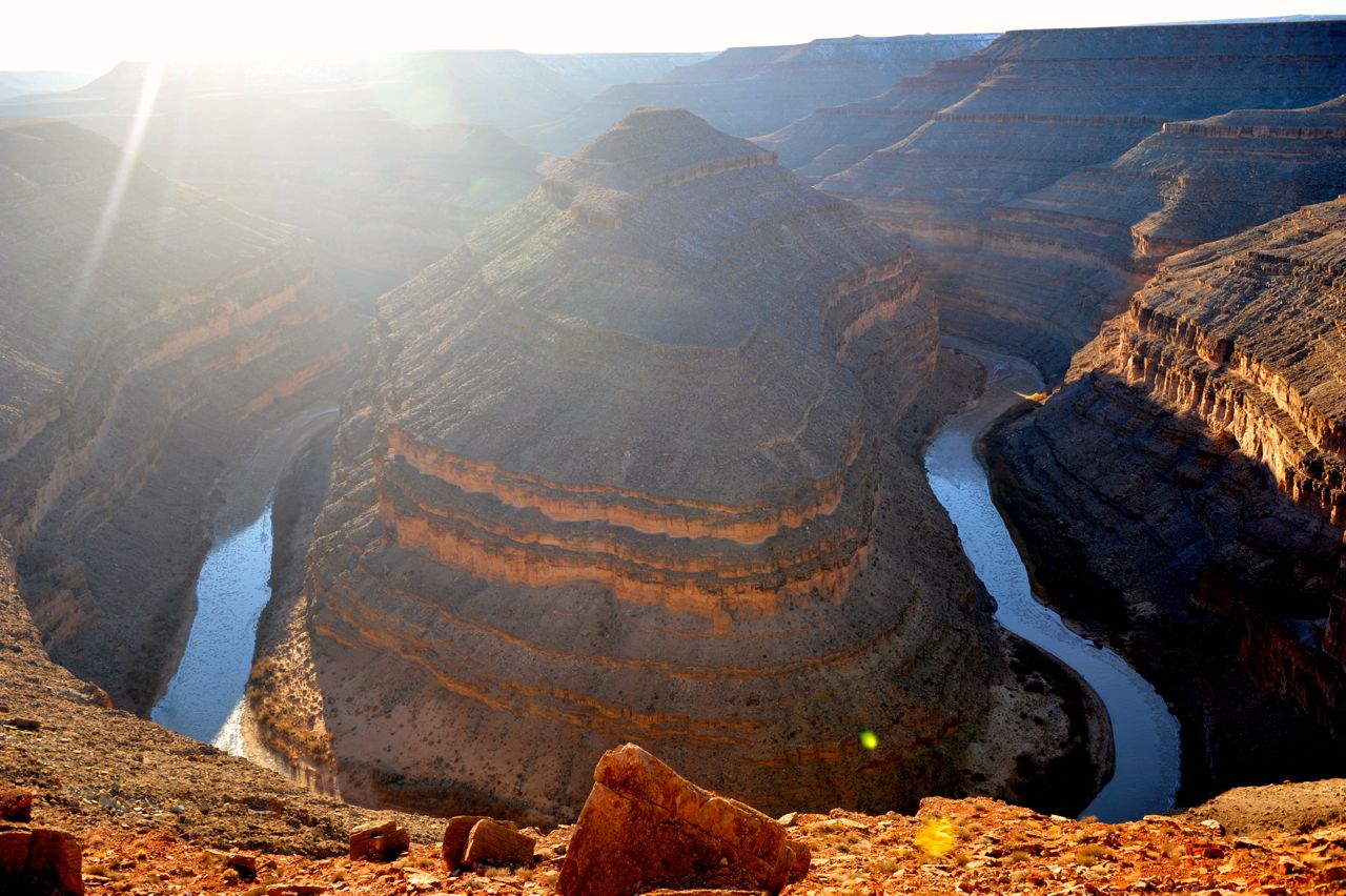
Grand Canyon National Park - visited in 2007 (fall), 2008 (summer), 2009 (spring), 2010 (summer), 2012 (spring and winter)
Great Basin National Park - visited in 2013 (spring) Mesa Verde National Park - visited in 2008 (summer) and 2012 (winter)
Petrified Forest National Park - visited in 2010 (summer)
Saguaro National Park - visited in 2013 (spring)
Zion National Park - visited in 2006 (fall), 2008 (summer), 2012 (spring) and 2013 (winter)


Parks of the Southwest:

Big Bend National Park - not visited yet
Carlsbad Caverns National Park - visited in 2010 (summer)
Guadalupe Mountains National Park - visited in 2010 (summer)


Parks of the Pacific Southwest:

National Park of American Samoa - not visited yet
Channel Islands National Park - visited in 2010 (fall)
Death Valley National Park - visited in 2007 (fall), 2010 (summer), 2011 (fall) and 2012 (spring)
Haleakala National Park - visited in 2009 (summer)
Hawaii Volcanoes National Park - visited in 2013 (spring)
Joshua Tree National Park - visited in 2007 (fall), 2010 (summer), 2012 (spring and fall)
Sequoia and Kings Canyon National Park - visited in 2009 (summer)
Yosemite National Park - visited in 2007 (fall), 2009 (spring, summer, and fall), 2011 (spring and summer), 2012 (winter)
Pinnacles National Park - visited in 2008 (fall), 2011 (spring), and 2012 (fall)


Parks of the Pacific Northwest:

Crater Lake National Park - visited in 2011 (summer) and 2012 (fall)
Lassen Volcanic National Park - visited in 2010 (summer)
Mount Rainier National Park - visited in 2011 (summer)
North Cascades National Park - not yet, likely next year on the way to Alaska
Olympic National Park - visited in 2011 (summer)
Redwood National Park - visited in 2005 (spring) and 2011 (summer)


Parks of Alaska:

Denali National Park - visited in 2013 (summer)
Gates of the Arctic National Park
Glacier Bay National Park
Katmai National Park - visited in 2013 (summer)
Kenai Fjords National Park - visited in 2013 (summer)
Kobuk Valley National Park
Lake Clark National Park
Wrangell-St. Elias National Park


Parks of the Rocky Mountains:

Badlands National Park - visited in 2013 (summer)
Black Canyon of the Gunnison National Park - visited in 2013 (summer)
Grand Teton National Park - visited in 2013 (summer)
Great Sand Dunes National Park -visited in 2010 (summer)
Rocky Mountain National Park - visited in 2013 (summer)
Theodore Roosevelt National Park - visited in 2013 (summer)
Glacier National Park - visited in 2013 (summer)
Wind Cave National Park - visited in 2013 (summer)
Yellowstone National Park - visited in 2013 (summer)


Parks of the East:

Acadia National Park - not explored yet at all
Biscayne National Park - visited in 2011/2012 (winter)
Congaree National Park - not explored yet at all
Cuyahoga Valley National Park - not explored yet at all
Dry Tortugas National Park - visited in 2011 (winter)
Everglades National Park - visited in 2011 (winter)
Great Smoky Mountains National Park - not explored yet at all
Hot Springs National Park - not explored yet at all
Isle Royale National Park - not explored yet at all
Mammoth Cave National Park - not explored yet at all
Shenandoah National Park - not explored yet at all
Virgin Islands National Park - not explored yet at all
Voyageurs National Park - not explored yet at all


I've also been to 35 out of 103 national monuments (Aztec Ruins, NM, Bandelier, NM, Cabrillo, CA, California Coastal, CA, Canyon de Chelly, AZ, Canyons of the Ancients, CO, Carrizo Plain, CA, Casa Grande Ruins, AZ, Cedar Breaks, UH, Chiricahua, AZ, Colorado, CO, Devil's Postpile, CA, Devils Tower, WY, Giant Sequoia, CA, Grand Staircase-Escalante, UH, Hovenweep, CO+UH, Jewel Cave, SD, Kasha-Katuwe Tent Rocks, NM, Lava Beds, CA, Montezuma Castle, AZ, Mount St. Helens, WA, Muir Woods, CA, Natural Bridges, UH, Navajo, AZ,  Organ Pipe Cactus, AZ, Rainbow Bridge, UH, Santa Rosa and San Jacinto Mountains, CA, Sonoran Desert, AZ, Sunset Crater Volcano, AZ, Tuzigoot, AZ, Vermilion Cliffs, AZ, Walnut Canyon, AZ, White Sands, NM, World War II Valor in the Pacific (HI part), Wupatki, AZ), 5 out of 18 national preserves (Denali, AZ, Katmai, AZ, Great Sand Dunes, CO; Mojave, CA; Big Cypress), 6 out of 46 national historic parks (Boston NHP, MA, Chaco Culture NHP, NM, Kaloko-Honokōhau NHP, HI, Puʻuhonua o Hōnaunau NHP, HI, San Francisco Maritime NHP, CA, Lewis and Clark NHP, OR), 5 out of 18 national recreation areas (Glen Canyon NRA, UH+AZ, Lake Mead NRA, NV+AZ, Golden Gate NRA, CA, Santa Monica Mountains NRA, CA, Whiskeytown NRA, CA), 1 out of 10 national seashores (Point Reyes, CA), and to none of 4 national lakeshores, 5 national rivers, 10 national wild and scenic rivers, 3 national reserves, 9 national parkways.

Actually, I do not aspire to see most of those places (e.g. majority of the historic sites sound pretty boring to me...) but I guess I would love to see all of the national parks. It looks like it will be a 10-year project!

Moreover, I would love to visit all 21 World Heritage Sites located in the US. As 13 of them are national parks, it shouldn't be too difficult. (The national parks on the list are: Carlsbad Caverns, Everglades, Grand Canyon, Great Smoky Mountains, Hawaii Volcanoes, Mammoth Cave, Mesa Verde, Yellowstone, Yosemite, Olympic, Redwood, Glacier, Wrangell-Glacier Bay NPs).

Remaining 8 positions on the UNESCO World Heritage Sites are:

Pueblo de Taos, NM - visited in 2010
Chaco Culture, NM - visited in 2012
Statue of Liberty
Cahokia Mounds State Historic Site, IL
Independence Hall
La Fortaleza and San Juan National Historic Site
Monticello and the University of Virginia in Charlottesville
Papahānaumokuākea

So far I've been to 12 out of 21 of World Heritage Sites, and I hope to be able to visit remaining 9 within next five years.

Wednesday, July 17, 2013

Alaska, Here We Come!

This is one busy summer. Less than a week ago we came back from a three-week-long trip to Yellowstone and surrounding national parks, and today we're flying to Alaska for two weeks.

Badlands National Park - One of the Highlights of the "Yellowstone Trip"


I sincerely hope Alaska will be as beautiful and intriguing as I imagine, as I've never had to work so hard to plan any other trip as this one. Planning the trip to Alaska took a lot of time because of two key reasons: (1) Not many places in Alaska can be reached by roads, hence the need to prearrange other forms of transport like small planes and/or boats; (2) Not many businesses in Alaska have good websites and online reservation systems, which meant that I needed to spend many hours on the phone calling one business after the other.

But now the planning phase is over and it's time to sit back, relax, and enjoy the new frontier :)


Saturday, April 20, 2013

Alamere Falls

One of my favorite waterfalls in the Bay Area is Alamere Falls, by some considered to be in top ten most beautiful waterfalls in the world.

What makes Alamere Falls unique is that it flows directly into the ocean. Moreover, it can only be accessed by a relatively long hike (4 miles one-way), which means that usually you can enjoy the beauty of the falls and surrounding them beach in solitude. A truly perfect spot for a relaxing picnic, a walk along the beach, a dip in the ocean, or a nap.

Alamere Falls flows directly into Pacific


Showering in Love :)


Horse-riding on the beach near the falls

The Upper Cascades of the Alamere Falls

The Upper Cascades of the Alamere Falls

Saturday, April 13, 2013

Self-portraits with Waterfalls

I have followed my own advice from the previous post and this weekend I spent exploring several waterfalls of Whiskeytown/Mt. Shasta area. During last three days we hiked over 30 miles and saw over ten waterfalls–all of which were amazing. We definitely are going to come back here for more waterfall hiking. In meantime, we have to be satisfied with the few waterfalls we saw and memories of them captured on film.

Hedge Creek Falls

Upper Brandy Creek Falls

Crystal Creek Falls

Testing our new car on the way to Whitney Falls (test passed)

Middle McCloud Falls


Tuesday, April 9, 2013

Waterfalls of California

There are many reasons why I've been terribly inconsistent in my blogging. The key one is that I'm trying to travel as much as possible this year, and in between travels I'm preoccupied planning the next adventure.

The plans for this year are very ambitious. In a week I'll be going to Europe for a month, where I plan to visit Estonia, Latvia, Belarus, Poland and Germany. Soon after that trip, I'll be going to Rocky Mountain and West North Central States for three weeks, where I plan to photograph nine national parks that I haven't visited before. As soon as that trip is over, I'll be flying to Alaska for more national parks and wildlife photography. And the culmination of my summer will be also its highlight: backpacking the southern half of John Muir Trail.

After that last trip, I hope to be able to slow down a bit, so that I can have time to process all the photographs accumulating on my laptop, as well as to work on some personal goals that require me to stay put rather than sleep five nights a week in a hotel.

Anyway, the purpose of this blog post is to let all my California friends know that the weather is perfect right now to go hiking on one of many waterfall trails that we have scattered all over the Bay Area and other parts of California. With the snow starting to melt in the mountains and recent rains, all the waterfalls are at their peak, waiting for you to pay them a visit. Don't disappoint them!

If you want my personal recommendation, the Cataract Falls Trail would be it. Take a look at the photos below to see how spectacular it looked just five days ago. Enjoy and let me know if you find some other great waterfall trails that I might not know about.


Sunday, March 3, 2013

Road Closed. Nature Vs. Humans 1:0

The wise John Muir once wrote "The world, we are told, was made especially for man — a presumption not supported by all the facts" (from A Thousand-Mile Walk To the Gulf).

This truth becomes especially evident at the end of Chain of Craters Road, in Volcanic National Park on Big Island in Hawaii. There, one can witness first-hand that it is Nature that sets the rules for our existence on Earth, not the other way around.


Just few years after it was build, the coastal portion of Chain of Craters Road was destroyed–along with many houses, ancient Hawaiian sites and the Volcano National Park visitor center–by a lava flow from  the Puʻu ʻŌʻō vent of the Kilauea volcano.


Despite the destruction, something beautiful was created–Nature's Museum of Modern Art, with thousands of unique forms and shapes of solidified lava. But more about it in the next post.

Friday, March 1, 2013

Fuming Volcano

To Anil the highlight of our trip to Big Island was the night swim with Manta Rays. To me it was seeing an active volcano. The most active volcano on Earth, in fact, Kilauea, which current eruption has started over 30 years ago, in January of 1983.

During the day, when the sun is high above the horizon, the volcano doesn't look very impressive or scary. Then it's simply a giant hole with a bit of white fume coming out of it. It's during the night when the volcano starts to look both imposing and magical at the same time. I was almost hypnotized by its radiant beauty, and despite the cold of the evening and occasional rain, I felt the red warmth of the volcano working its way through my body to keep me warm, engaged, and happy.

Kilauea at night.


Kilauea at sunrise.


Wednesday, February 27, 2013

Full Moon over Big Island

The full moon over Big Island was amazingly bright last night. So bright that I needed to bring down the exposure to 1/500 of a second (at f5.6) to take a photo that wouldn't be overexposed and would show the moon's dark volcanic maria, bright crustal highlands, and some of its prominent craters.


This was the first time I shot the moon as the main subject. I was surprised how easy it was and I feel encouraged to try more of this type of photography.

Tuesday, February 26, 2013

Night Swim with Manta Rays

Last weekend we spent in Hawaii snorkeling, beach bumming, whale- and dolphin-watching, hiking active volcano, and–most awesomely–taking a night swim with more than 10 giant Manta Rays.

Check out the movie I took with my underwater camera to get a preview of what we were fortunate to experience. If you ever happen to go to Big Island in Hawaii, the night snorkeling with Manta Rays is a must!

Tuesday, February 5, 2013

Thursday, January 24, 2013

My Home and Backyard As Seen from the Orbit

This is how my home and backyard look from up above.

Photo twitted from orbit by Chris Hadfield


Isn't the Bay Area stunningly beautiful? And it only gets better the closer you look.

Thursday, January 10, 2013

Scenic Drive through Monument Valley Navajo Tribal Park

I've been to Monument Valley Navajo Tribal Park twice: once in summer and once in winter. Contrary to all the other places in the South-West–which I find prettier and more interesting during winter–I found Monument Valley more scenic during summer.

Monument Valley in Summer


I think there are two reasons for that. First, Monument Valley doesn't get enough snow during winter and, therefore, it isn't uniformly covered by it. To me, the patches of snow make the Valley appear more "messy" and less "monumental." Second, contrary to the summer skies, during winter skies are usually clear and cloudless, which translates to less dramatic views and less original photos.

Monument Valley in Winter


Still, we found the 17-mile Scenic Drive through the Valley very enjoyable and we would recommend it to anybody passing through that part of the world, no matter what time of the year you're there.

Scenic Drive through Monument Valley


The drive took us close to many interesting rock structures, like the two "mittens"–East and West Mitten Buttes–pictured on the photo below.

Yours truly with East and West Mitten Buttes


To some, the rock on the photo below resembles a camel and, therefore, it got named Camel Butte.

Camel Butte


Here are the Yei Bi Chei-­Navajo spiritual gods–and Totem Pole.

The Yei Bi Chei and Totem Pole


Look how small our car is compared to the nearby rocks.

My Love and his red toy in the Monument Valley


Looking back at some of the photos I took during my recent visit to the Monument Valley, makes me see how the Valley got its name. It does look quite Monumental in places.


Wednesday, January 9, 2013

Escape from Civiliazation: Valley of the Gods

If you want to escape from civilization, look no further. Valley of the Gods, mere 40 miles north-east of the world-famous, tourist-infested Monument Valley, has no crowds, no cell-phone or radio reception, no paved roads, no restrooms and/or any other facilities, yet by many it's considered to be more spectacular than its aforementioned famous cousin.


We spent two hours there and saw only one other car somewhere in distance. What a stark contrast to Monument Valley, where you see at least five cars at each single viewpoint or turn of the road. Additionally, there is no fee to enter Valley of Gods, and you're welcome to do there whatever pleases you: you can camp there (again for free), go hiking anywhere you want, or even do some bouldering/rope climbing. Valley of the Gods is yours to play with.


Similar to Monument Valley, the most prominent rocks in the Valley of the Gods have names. These names are typically meant to describe what the rock formation resembles, so for example in the Valley of the Gods you can Setting Hen Butte, Lady in the Tub, Battleship and Seven Sailors. It's actually lots of fun to try to look for those shapes in the rocks.

On the left: Lady in a Tub


There's only one road leading through the park: a bumpy 17-mile-long dirt and gravel road with many steep sections and sharp turns. As I'm a road, not destination, kind of person, I had lots of fun driving there and I loved that each bend in the road hold a surprise: a new rock formation or a new scenery.


The best time to visit the Valley of the Gods is in late afternoon, when the sun is low and the rocks glow in beautiful warm red color.

On the left: Setting Hen Butte


Sunset is a great time too, as it emphasizes the ruggedness of the landscape.


Tuesday, January 8, 2013

Goosenecks State Park

Goosenecks State Park offers a one-of-a-kind scenic view of the meandering San Juan River and the deep canyon painstakingly cut by the river over thousands of years.


Near the viewpoint, the river makes a series of tight turns–goosenecks–which give the park its name.


The viewpoint is located about 1'000 feet above the river and offers a simultaneous view of three of the San Juan River goosenecks. However, even my wide-angle lens wasn't able to fit all of them in one photo. So I'm leaving this to your imagination, or encourage you to visit Goosenecks State Park yourself.


There are no hiking trails in the park and its sole purpose of existence seem to be to provide the views of the river, yet it's worth seeing at least once in your life.


However, if you go there, learn from my mistake and visit the park in the morning or during the midday, as in the late afternoon the sun shines directly above the goosenecks, making photography almost impossible.