Saturday, July 30, 2011

Marshmallow Challenge

Marshmallow Challenge is a good team-building exercise that encourages collaboration and creativity, at the same time teaching the importance of prototyping and not making (false) assumptions. It is a fantastic icebreaker for any meeting, does not take too much time and does not require too many resources.

In fact, the only resources you need are:
  • 20 spaghetti sticks (uncooked)
  • 1 marshmallow
  • 1 meter of string
  • 1 meter of tape

The task is to build, using only resources provided, the tallest freestanding structure with a marshmallow on top, within 18 minutes. I gave this task to my labmates at the beginning of the lab retreat that we had recently, and I'm proud to report that two groups out of four, managed to build quite impressive two-story structures!

Before I gave this task to my labmates, I wanted to test myself in it, so I asked Anil to be my teammate and to build the marshmallow structure together with me. I was very pleased to find out that we had exactly the same approach to the task. We first started with drawing a model, and only after we agreed on it, we started building the structure.

We decided that a three-sided base is the most optimal taking into account the resources we had, which proved to be true. However, we hoped to build a three-story structure, which we failed to do as we run out of time. Still, I'm quite pleased with the marshmallow structure we built. It is not as easy as you might think!

Our marshmallow-spaghetti structure:

Thursday, July 28, 2011

My Very First Art Show

My very first, and hopefully not last, art show took place at the beginning of May at Mission Bay Campus of UCSF. Three years ago UCSF started a tradition of annual art shows displaying artworks by its employees. The two previous years the show was located on the ground floor of the building in which I work, but this year it took place in the atrium of the Bakar Gym. I believe it was a huge mistake.

The organizers probably hoped that hosting the show near the gym entrance will ignite more interest in it, but I do not think that was the case. People who come to the gym are usually in workout-oriented mindset and are not particularly interested in looking at art. Secondly, there are often IT/biotech/pharma exhibits and conferences happening there, so likely, with time, most gym members learned to ignore anything that happens in the gym's atrium. Thirdly and most importantly, the light in the atrium was simply terrible! It was so dark there that enjoying any artwork would not be possible.

The old location, on the ground floor of the Genentech Hall, was much better. There is much more light there and also there were more people interested in taking a break from work and enjoying the art. Hopefully, the organizes made the same observations as I did and will revert to the old location next year.

Despite these setbacks, the art show was a good learning experience for me. I learned the importance of the proper display of art, and I learned that I should make my art more visible by making it bigger :) As I planned to display six pieces, I decided to keep them relatively small (each piece was only 11 inches by 14, including the frame). However, after I submitted my artwork to the organizers, they told me that there is a limit of three pieces per artist. Needless to say, that rule was not communicated to me before. I found it tough to drop half of the series, and I was also not happy that I had to stick with the small photo sizes... I'm sure that my photos would have attracted much more attention, had they been larger.

On the positive side, despite all the things that went wrong, there was a considerable number of people who seemed to be interested in my art pieces:


"Colors of Namibia" - the six pieces series I wanted to display:


Poster-invitation for the show:

Tuesday, July 26, 2011

Magic Bus

In the middle of May we went with our friends Aldona and Witek on the Magic Bus tour through the San Francisco's '50s, '60s and '70s.

The tour was interesting, even though it was very different from what I had expected it to be. I thought that the Magic Bus would be a hippie bus from the '60s on which we would relive the "summer of love" be listening to and singing along the songs from that era. However, that was only a small part of the tour. It seemed to me that every single time that we started relaxing and getting into the good mood stimulated by the songs of the '60s and '70s, the screens on the bus' windows would remind us about the dark side of those times: war in Vietnam, assassinations of the Kennedys, King, Moscone, Milk and John Lennon. If you ask me, I would enjoy the tour much more if the gloomy events were given less prominence, and if we were allowed to sing more.

Still, I thought the tour was pretty good and well done. As you can see in the photos below, on the bus the audience/passengers sit facing side windows, which can be converted into the projection screens. As the bus rolled over various neighborhoods of San Francisco (Chinatown, North Beach, Financial District, Haight-Ashbury, and Golden Gate Park), the projection screens would roll up to reveal the beauty of the city and to let us have a look at the places that were just mentioned on the documentary. A pretty cool concept!


The Magic Bus:

Inside the bus:

Summer of Love:

If you're going to San Francisco, be sure to wear some flowers in your hair:

Aldonka and Witek in front of the bus:

And in front of the heart of San Francisco:

Sunday, July 24, 2011

Auntie's B-day

Both in Indian and Polish culture, close friends of the parents are often referred to as "uncles" and "aunts". Though I think this term is more liberally used in India as Anil seems to have at least ten times as many extra aunts and uncles as I have :)

In the middle of May we went to the 80th birthday party of Auntie Kaumudi, the wife of our favorite uncle who helped us immensely with our last year's wedding preparations. We could not believe that the auntie is already 80 as she does not look more than 65. I certainly hope that I'll manage to age as gracefully as she did.

The party took place at an Indian restaurant, Athidhi. There were around 100 guests, mostly Indians, now that I think of it :) Almost all women wore beautiful saris, so I regret that I decided against wearing one too.

The atmosphere at the party was relaxed and food was good, so we had a very good time and met several interesting people. Mostly, we were very happy for our auntie and uncle, and it was great to be part of their celebration. In these turbulent times, it is wonderful to see people who have been married for 40+ years and still treat each other with uttermost respect and adoration.


A few pictures from the party:


Auntie, uncle, their daughter, son and grandson:


Traditional cake feeding:


Neeta, Gautam, Aditi and Ram:

Anil, I and Aditi:

All of us with Auntie and Uncle:

Friday, July 22, 2011

McWay Falls in Julia Pfeiffer Burns SP

37 miles south of Carmel and 3 hours away from San Francisco is little paradise called Julia Pfeiffer Burns State Park. The park is made famous by McWay Falls, an 80-foot waterfall that drops directly from granite cliffs into the Pacific ocean. The falls can be seen from the 0.5-mile long Overlook Trail. Sadly, even though the trail is paved, it is not wheelchair accessible as it starts with a set of stairs.

The falls are magnificent and definitely worth seeing. If you would like to photograph them, then better visit the park in the late afternoon and don't forget to bring your ND filters! I regretted not having mine with me... From the Overlook Trail there are also wonderful views of the ocean and it is possible to see whales from there as well. We got lucky and saw a group of three moving close to the shore, which was amazing. They were too fast and that I did not manage to take a single good photo of them appearing at the surface of the ocean, but I'm posting one of them anyway as a proof that we in fact saw them.

There are several other trails in the park (Ewoldsen, Partington, Tan Bark) but, sadly, they were all close when we were there. I suggest that you check the park's website before you go there as it contains current information on both Hwy 1 and trails' closures.


Seven takes on McWay Falls:


Whales:

Wednesday, July 20, 2011

Soberanes Canyon in Garrapata SP

In Garrapata SP we initially planned to hike a 7 mile loop consisting of the following three trails: Soberanes Canyon, Peak and Rocky Ridge. Unfortunately, at the beginning of the trail we noticed a small message informing hikers that part of the loop is inaccessible due to severe trail erosion. We decided to hike there nonetheless and we opted for hiking the open part of the Soberanes Canyon Trail. At first the trail led us through cactus and chaparral-covered hills, but soon we ended up in a narrow canyon filled with redwoods. It was a nice change after hiking along the coast. It also reminded us, yet another time, how blessed we are to live in a such spectacular area of the world as California.

The hike was very pleasant, though short (3-miles round trip). I hope the other part of the trail will reopen soon and we'll have a chance to do the full loop, as I'm sure it is also beautiful. Its beginning definitely looked promising.

Garrapata SP is located on both sides of Hwy 1, 7 miles past Rio Road in Carmel. It is easy to miss it as no big signs advertise its presence. Hence, I would recommend using a GPS or following your cars mileage meter. The Soberanes Canyon Trail starts on the eastern, inland part of the park, but there are also several short trails on its western side. All of the latter lead to the Pacific ocean and offer great views of the coast.


Wildflowers along the trail:


The trail crossed Soberanes Creek several times:

Redwood Grove:

The coastal part of Garrapata park:

Wildflowers:

Monday, July 18, 2011

Asilomar Coast Trail

Asilomar Coast Trail, located in Pacific Grove, might be the most spectacular family-friendly coastal hike in California. The trail is well-maintained and level, and for the most part it is actually a boardwalk. It is also right off the side of the road, so getting there is pretty easy. As for the views, well, they are truly spectacular. The hike leads along the rocky bluffs above rugged Asilomar Beach overlooking the Pacific ocean, the color of which here is just amazing. Sometimes it is deep blue, sometimes azure, sometimes turquoise. All of these colors contrast really well with almost-white sand of Asilomar Beach.

If you hike this trail during the right time of a day, you might be able to see some interesting animals and plants in the tide pools. And if you visit during spring, like we did, you will be rewarded with a carpet of wildflowers.

The hike is just 1.2 miles (each way), but likely it will take you at least 1 or 2 hours as you will be enjoying yourself so much that you will not like to leave. Access to the hike and the beach is free and the parking can be found on the side of Sunset Drive, in Pacific Grove, just opposite the historic conference center at Asilomar. Curiously, the Asilomar conerence center was designed by Julia Morgan, the same architect who later designed Hearst Castle.


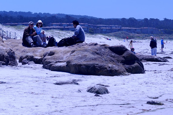
Rugged Asilomar Beach:

Lunch on the rock:

My love:

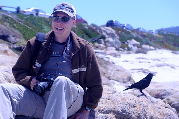
Luis and friendly crow:

Wildflowers:

My love and I:

More wildflowers:

Boardwalk:

A seagull on a rock:

An amazing sand castle on a rock:

Della and Luis, our hiking companions:

Saturday, July 16, 2011

Jacks Peak County Park

Recently, our hiking karma was not too good. Already at the end of March I planned to go hiking in Julia Pfeiffer Burns State Park, famous for its 80 feet waterfall falling directly into ocean. We could not fulfill this plan as there was a mudslide on Hwy 1, blocking the access to the park.

After the highway reopened, we attempted to go to the park again and again we were close to failing! This time because of Big Sur Marathon, which closed a major part of Hwy 1 south of Carmel on the day that we picked to go there. I just could not believe our bad luck. But I was also determined to finally see the falls.

We decided to return to Hwy 1 after it would reopen (at 2 pm that day) and to find another hike in the vicinity to keep ourselves busy until then. Luckily, the Monterey area is also full of great hikes, so we did not have any problem finding two that suited our plans. First, we decided to go for a short, 1 mile, hike in Jacks Peak County Park. Jacks Peak, at 1068ft, is the highest point on the Monterey Peninsula and my guidebook promised that it would offer spectacular views of Carmel Valley, the Monterey Peninsula, Point Lobos, the Santa Lucia Mountains, and the Pacific Ocean. Unfortunately, things have changed a lot since the time this part of the guidebook was written. When we got to the top of Jacks Peak (via Skyline Nature and Jacks Peak Trails), we were surprised that it was absolutely impossible to see anything from there, due to heavy forest coverage. So even though the hike was pleasant, I would not recommend it.

From Jacks Peak Park we drove to Pacific Grove, where we hiked Asilomar Coast Trail (to be described in the next post). By the time we finished that hike it was already 2pm, so we could come back to our initial plan and continue south on Hwy 1 to hike in Garrapata and Julia Pfeiffer Burns State Parks (also to be described in the following posts).


Even though we were disappointed by the lack of views from the top, we were pleased to see many of these pretty butterflies:

Catching a butterfly in a flight is a true challenge!

Spring in the air:

An interesting snake:

There were better views from the road leading to the park rather than from the top: