Sunday, October 31, 2010

Aditi & Ram's Birthday Party

Yesterday my beautiful niece and nephew were celebrating their 5th and 2nd birthdays, respectively. The party was in the park and there were lots of other kids. The weather was good and everybody had lots of fun. The boys were mostly playing with balls, and the girls were pretending that they are princesses. Luckily, there are many fairy tales, each with its own princess, so that every girl at the party could be a different princess. Even I was nominated to be a Mermaid :)

Ram playing with his new ball. We tried to teach him that it was a soccer ball and should not be touched with hands, but we were not too successful:

Princess Aditi playing (and winning!) a "clown" game:

Delicious birthday cake:

Neeta, Gautam, Aditi and Ram cutting the cake:

Saturday, October 30, 2010

Mt Rose

We planed to hike to the top of Mt Rose which, at 10,776 feet (3'284m) above sea level, is the third highest peak in the Tahoe basin. Unfortunately, two days of heavy rain- and snowfalls forced us to change our plan.

We did not mind hiking in the snow, but we were worried that it might be too dangerous to drive in our small car on the steep and windy mountainous roads that surely would have became icy by the time we would have been coming back from the hike. Therefore, we decided to turn around and instead go hiking in the slightly lower mountains near Truckee.

Before we did that, we went for a short walk in the forest along the Mt Rose Highway, near the place we turned around:


Friday, October 29, 2010

Lake Tahoe

During our recent holidays we first went to the mountains north of Lake Tahoe, and then we drove south to Desolation Wilderness. Below are few photos of Lake Tahoe that we took along the way:

Thursday, October 28, 2010

Reno

The sole reason we went to Reno was that one of Anil's cousins gave us a free voucher for two nights at one of the hotels there. The hotel was called "Atlantis" and as most (if not all) hotels in Reno it doubles as a casino.

Compared to Las Vegas, Reno looks pretty sad. The hotels/casinos there are much smaller and less lavish, there are much less people on the streets, less live shows, and less nightlife in general. It also seems that Reno is not popular with younger people, as the vast majority of people we saw there looked 60+.

We did not mind any of that, as we were using Reno only as a base to explore nearby mountains.

Reno, the biggest little city in the world:


Our hotel:


Reno as seen from a funky elevator at our hotel:

Wednesday, October 27, 2010

We are back

We did not get eaten by bears and we did not freeze to death :)

The highlight of the trip was crossing of a 20-feet-wide creek with the knee-high freezing-cold water. Unfortunately, I do not have any photos documenting this part of our trip as my husband refused to spend a second longer than necessary in the creek. But I took lots of other pictures that will appear here soon divided into 5 posts:
  1. Reno
  2. Lake Tahoe
  3. Mt Rose
  4. Mt Judah Loop
  5. Desolation Wilderness - Backpacking to Half Moon Lake

Tuesday, October 26, 2010

Joshua Tree NP - Cholla Garden

My dearest friend Bartek joined us on the second day of our stay in Joshua Tree NP and we continued exploring the park with him. The first place that we saw together was "Cholla Garden", which is a place of dense concentration of Cholla Cactus. There is 0.25 mile long nature walk leading through it, during which you can learn many interesting things about the life and reproduction of Cholla.

Cholla is also known as a jumping cactus. The name comes from the ease with which its stems detach when brushed. Even the slightest touch will make the bits of cactus jump at you and cling to you and your clothes. So even though it does look pretty and soft, do not touch it! Its spines will go deep into your skin and it will be very hard to remove them.

The warning sign at the beginning of the trail:


Blooming Cholla:


My husband and Cholla in all their glory and beauty :)

Monday, October 25, 2010

Joshua Tree NP - Lost Palm Oasis Hike

It must have been at least 110 degrees Fahrenheit (43 Celsius) and absolutely no shade when we arrived at Joshua Tree NP. We decided to first set up a tent, and then go hiking, as we hoped heat would lessen later in the afternoon.

At around 4:30 pm (~ 3.5h before sunset) we set out for a 7.2 miles (11.6 km) long hike to the Lost Palm Oasis. That was an excellent choice as it was one of the best hikes that I did in 2010. The views were not spectacular and it was unbearably hot (I was wearing a wet scarf and a wet cap on my head to prevent heat stroke), but the number of interesting animals and plants that we saw there was simply astounding. Every few meters we would encounter a new lizard, bird or plant. It was also the first time in my life that I saw a chuckwalla, several two-horn lizards, and even a rattlesnake!

The rattlesnake waited for us near the end of our hike, and gave us a lot of trouble passing next to it. It was a very frustrating situation: we could already see our car, we were maybe 10-15 minutes away from it, and we found ourselves unable to get to it...

Every time we tried to take a step forward, the rattlesnake was starting to rattle! There was no way that we could go around it either, as there were rock boulders both to the left and to the right of the snake. Scrambling through them did not look as much fun, and also, we decided that it was very likely that there would be other snakes there. And it would have been much more difficult to run away from a snake on the boulders. It was also not helping our situation that the sun was pretty low at that point in time and it was slowly starting to get dark...

Therefore, we (husband) decided that our best option was to try to pass in front of the snake. We tried to walk as far away from the snake as possible, which was maybe like 5 feet (1.5 meter) away... Trust me, it was definitely to close as for my comfort zone... Luckily, the snake decided to give us a break (probably it could smell our fear) and let us pass through.


During the hike we saw lots of lizards. Next to photos show a male and a female of the same species:


A two-horn lizard:


Other lizard:


Jack Rabbit hiding in the shade:


Apparently this beetle stands on its head when it pretends that is dead...


Blooming Ocotillo and a bird:


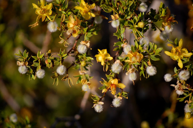
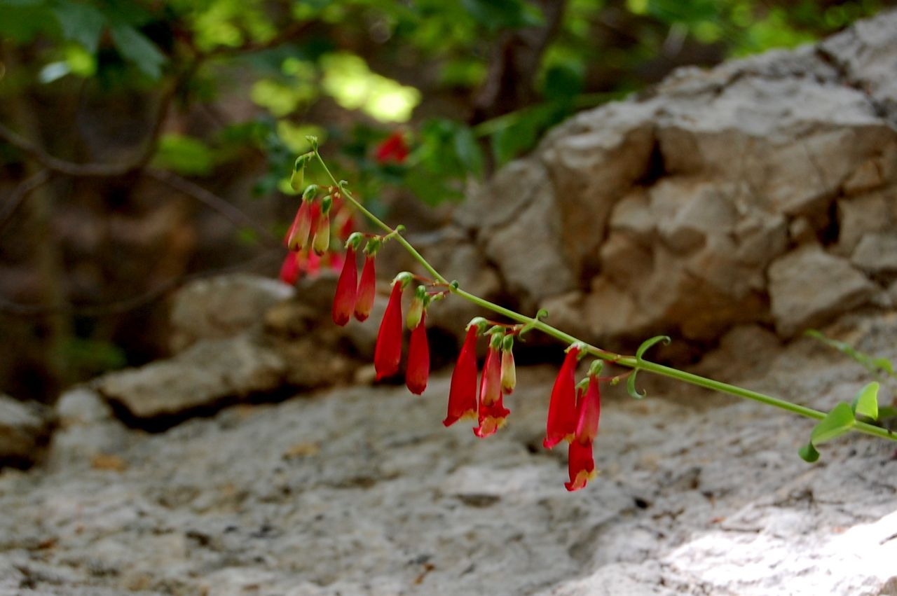
Some plants that we saw during our hike:


The Lost Palm Oasis:


We were so excited about seeing the rattlesnake that my hands were trembling and I was unable to take a good picture of it. Also, my dearest husband forgot to take a movie of it, which would have been awesome as you could hear the rattling on it...


Sunday, October 24, 2010

Mojave Desert

Driving through the Mojave Desert is like riding on a roller coaster.

The road leading through it is bumpy and full of deep dips, and if you drive fast enough, your car will jump along nicely :) I would definitely recommend trying it out (at your own risk) if there is no traffic.

Here is a short, uncut, unedited movie shot in the Mojave Desert (no dips in this one):

Saturday, October 23, 2010

Lake Tahoe & Reno Trip

My better half is coming back home this Sunday after a two-week long trip. Needless to say, I have missed him terribly and I can not wait to see him.

Luckily, we both have flexible jobs and can afford to take a few days off to spend some quality time together. As soon as Anil lands in SF, the two of us are going for short holidays to Reno/Lake Tahoe area. Hopefully, the weather will be good and we will be able to go for all hikes that I've planned for us :)

The most exciting part of our trip should be a two-day backpacking trip to Paradise Lake. It will be the very first backpacking trip for Anil, so I'm really curious to see if he will like it and how well he will deal with carrying 30lbs+ on his back...

I'll try to post a trip report as soon as we are back. In meantime, you can enjoy a few more posts from our honeymoon. I made sure that new posts will be appearing here (one a day) even when we are away.

Change of Plans

The plan for the second week of our honeymoon was to visit several parks and cities located along the southern boarder of the US. However, because of unexpected and rather unpleasant immigration-related issues, we decided to change our plans and head north. Instead of visiting Chiricaruha NM, Tucson, Saguaro NP, Organ Cactus Pipe NM, Anza Borrego SP and San Diego, we went to Lower Antelope Canyon, Bryce and Joshua Tree NPs. That added several hundred miles to our trip, but we did not mind it that much as we both like driving.

Before leaving for the honeymoon we were wondering if we should have taken our passports with us. We did not plan to cross the US border, but we worried that we might need them because of the new immigration law in Arizona. In the end, I decided not to take my passports (Yes, passports. I had two at the time: the "old" one with a maiden name and a current visa, and the new one, with my new name). I did not want to risk loosing them and also carrying two of them (plus some other immigration-related documents) seemed just too complicated.

I had no idea that all along the border between Mexico and the US (as well as Canada and the US) there are numerous internal immigration checkpoints that can be located as far as 75 miles away from the border... We got stopped at one of such checkpoints on the I-54 near Alamogordo, NM (some 50 miles away from the Mexico border...)

The first immigration officer we dealt with was very nice and friendly, but the second one was clearly in a bad mood. It also did not helped that he could not locate a person with my new name in their system... Luckily, I also had with me my old driver's license with the maiden name. That saved us from a lot of trouble.

Even though this "adventure" ended well, we decided not to risk getting into potentially more trouble by continuing along the southern border of the US. At the very least we were risking loosing time at each checkpoint, but in the worst case - well, I have no idea what could really have happened in the worst case, but we decided not to find out :)

Friday, October 22, 2010

Guadalupe Mountains NP - McKittrick Canyon Hike

From Carlsbad Caverns NP we ventured into Texas and Guadalupe Mountains NP located there. The two parks are actually located in the same mountain range and are only about 25 miles (40 km) apart.

Guadalupe Mountains NP looks pretty inconspicuous and I'm sure most visitors (including us) must wonder why it deserves the status of national park. This question gets addressed in the park's leaflet: the park protects the world's finest example of a fossilized reef.

In the park we went for a hike in McKittrick Canyon, which offered a very welcome change of the scenery for us. We had spent so many days in deserts that we were very happy to finally find ourselves in a forest. In fact, we must have been so fed up with hot and arid places, that we continued the hike despite two thunderstorms that were following us, both on the way to the Grotto and back. (Yes, I thought it was amazing that the wind's direction changed as soon as we started hiking back, and that we needed to run away from rain and thunder twice...)

All in all, the hike was 6 miles round-trip and took us around 3h. It was nice, but nothing too impressive... I guess we would have to be geologists and/or fossil hunters to be able to appreciate it more.

My Jedi:


McKittrick Canyon:


The historic Pratt Lodge, former vacation home of Wallace Pratt, a petroleum geologist who donated the lodge and land to the NPS to establish the park:


Grotto:


There were some pretty plants in the park:


The park was full of huge crickets who were also unbelievably loud:


My hiking shoes were shining after the hike ;) :

Thursday, October 21, 2010

The City Club of San Francisco and Allegory of California

Last Monday, Anne, Sebastian and I went for a guided tour of the City Club of San Francisco, located in the former building of the Pacific Stock Exchange.

The interior of the City Club is considered to be the best example of the Art Deco style in San Francisco. However, a true highlight of the tour was "Allegory of California", the very first mural that Diego Rivera painted in the US. It was a rather controversial decision to commission painting of the mural for the Stock Exchange to a well-known communist...

The City Club is not normally open to the public, so the only way to see the mural is to go on a guided tour. Such tour is offered for free (a small tip is encouraged and appreciated) once a month by the San Francisco City Guides.

We were expecting Rick Evans of San Francisco Architecture Walking Tour to be our guide, but unfortunately, he did not show up. The older lady that was leading the tour instead of him, was just not as knowledgeable and engaging. Still, it was time well spent as both the mural and the interior of the City Club are definitely worth seeing.


Diego Rivera's 32-ft high Allegory of California fresco finished in 1931:


The beautiful brass balustrade on the grand staircase between the 10th and 11th floors designed by Robert Boardman Howard:


The Main Dining Room on the 11th floor:


The Cafe on the 10th floor:


The English hunting scenes by Otis Oldfield on the windows of the Wine Cellar:


The entrance hall to the Pacific Stock Exchange Club:


The ceiling of the entrance hall:


The building's facade with Doric columns and sculptures "Agriculture" and "Industry":