Showing posts with label Grand Canyon. Show all posts

Monday, December 13, 2010

Grand Canyon Backpacking: All Posts

Oh boy, it does feel good to finish things. Hereby I declare that I have finally completed and published all posts from my Grand Canyon Backpacking Adventure! Here they are:
  1. Grand Canyon - South Kaibab Trail
  2. Grand Canyon - Bright Angel Campground
  3. Grand Canyon - Clear Creek Trail
  4. Grand Canyon - Plateau Point Trail
  5. Grand Canyon - Bright Angel Trail

I still have around 80 unfinished posts. More or less half of them are from my 2006 trip to Africa (yes, 2006...) and the other half are from the 2009 trip to India. (Update: I've recently started working on the posts from India, and I'm planning to be posting them here throughout January till the middle of February.)

I have no idea when I will get around to working on posts from Africa - I think I would need at least a month off from work to finish them. Or at least not travel at all during the next year. The latter one is definitely not going to happen.

We are about to leave for Peru, and then also next year we plan to visit my family in Poland, Anil's family in India and hopefully also go for at least a week of holidays by ourselves (e.g. maybe on a road trip to Yellowstone NP, or along the coast all the way to Seattle). Taking a month off also does not seem likely right now, unless we will win a lottery :) (We really should start playing...)

Sunday, December 12, 2010

Grand Canyon - Plateau Point Trail

From Indian Garden we went for a short (3.2 miles/5.2 km round-trip) hike to Plateau Point, which provides absolutely fantastic views of Grand Canyon and the Colorado River. As we were staying at Indian Garden for a night, we were able to hike to Plateau Point late during the day and catch a sunset there. That made our experience even better, though I think views from Plateau Point are spectacular at any time of a day (and maybe even night, if there is a full moon).

The Plateau Point Trail is very easy and almost completely flat, so it can be hiked without any problems even during a night. We spent a good hour at Plateau Point enjoying the view of the late evening sun kissing Grand Canyon goodnight, and only started hiking back to our camp when it started to get dark. By the time we reached Indian Garden, it was pitch-dark and most other hikers were getting ready to sleep. We, however, gathered for the last meal together, which was a special treat prepared by our friend Carsten. Imagine that he made a cheesecake and carried it all the way down the canyon (and a half way up) to share with us!

Grand Canyon and the Colorado River at sunset:


Saturday, December 11, 2010

Grand Canyon - Bright Angel Trail

We decided to hike out of Grand Canyon on the Bright Angel Trail as it is the canyon's easiest trail connecting its bottom and rim. It is well maintained, at regular intervals it has taps with drinking water, and there is even a ranger station located at the trail’s halfway point.

It takes 9.6 miles (15.5 km) and 4'320 feet (1'137 m) to get from Bright Angel Campground at the bottom of the canyon to the canyon's rim. It is a distance that certainly could be covered during one day, but we decided to split it into two. We figured that it would be more enjoyable and less exhausting that way.

During the first day we hiked 4.7 miles (7.6 km) and, in a result, got 1320 feet (404 m) closer to the rim of the canyon. It took us only around 3-3.5h to cover this distance, so after setting up the camp and resting for a bit, we decided to catch a sunset at Plateau Point.

On the second day we needed to hike remaining 4.9 miles (7.9 km) and more than twice as much in the elevation change (3060 feet/933 m) as on the previous day. That was definitely the most physically exhausting day of our trip. Still, all of us did very well and we kept a good speed. (It took us 4h to cover this distance, which I think is pretty decent taking into account the elevation change and that we carried heavy backpacks.)

The hike starts with a river crossing:


The view of Grand Canyon from the trail:


Near Indian Garden we got lucky and saw several Californian Condors:


Indian Garden is located in a beautiful green valley:


On the second day the trail was much steeper:


The hikers share the trail with the mules:


The last glimpse of Grand Canyon:

Saturday, September 25, 2010

Grand Canyon - Clear Creek Trail

One of the reasons we decided to go backpacking vs day hiking in the Grand Canyon was that we wanted to fully appreciate its beauty and grandeur and, therefore, we did not want to rush through it. That's why we decided to spend two nights at the Bright Angel Campground. It allowed us to have a full day to explore the bottom of the canyon, which we used to go hiking on the Clear Creek Trail.

The Clear Creek Trail is very beautiful and offers great views of the Colorado river, as well as of the lower part of the South Kaibab Trail that we hiked the day before:


Hiking on the Clear Creek Trail:


The six brave hikers: Anne-L, Sebastian, Anne-K, Carsten and his gf, and I:


The collard lizard that we met on our way:


And here is an amazing fossil that Anne-K found:

Thursday, September 23, 2010

Road Trip 2008: Grand Canyon NP (North Rim)

[This is a long overdue report from my 2008 visit to the North Rim of the Grand Canyon. Only now that I started working on my honeymoon Grand Canyon posts I realized that I had never finished this particular post (and also a few others from my trip through Southwest with Agnieszka...) This post belongs to Grand Circle 2008 series of posts.]

After spending two days at Zion NP, Agnieszka and I drove to the North Rim of the Grand Canyon NP, where we spent the next two days and nights. For me it was already a second visit to the Grand Canyon, but first to the North Rim. I had close-to-traumatic experience during my visit to the South Rim year earlier, so I feared that this one would not be any better. Luckily, the North Rim is not as popular with tourist as the South Rim, and, thanks to that, we could enjoy the beauty of the canyon much more.

The first thing that we did upon arrival to the North Rim was to go for a scenic drive to Point Imperial and Cape Royal. Point Imperial, at 8,803 feet (2,683 meters), is the highest point on the North Rim. It overlooks the Painted Desert and the eastern end of the Grand Canyon. Cape Royal, on the other hand, offers sweeping views of the canyon and seemingly unlimited vistas in all directions. It is a perfect place to watch both sunrise and sunset. (We did watch one of the sunsets and one of the sunrises there and it was definitely unforgettable experience.)

The third viewpoint that we visited was Bright Angel Point that is accessible by a short paved (0.5 mile/0.8 km round trip) trail. It is also a popular sunset viewpoint, but not as impressive as Cape Royal. Still, from there I took the best photo of the Grand Canyon that is thus far in my collection. It is not because this viewpoint is more spectacular than others. We just got lucky to catch a storm, and a rainbow forming after it, on the South Rim!

Here is my favorite photo. If you enalarge it, you wil be able to see a storm and a rainbow on the other (southern) rim of the canyon:


On the second day of our stay at the North Rim we went for a hike to Roaring Springs. It was a fantastic hike that I absolutely loved and would like to repeat sometime soon. It was a part of the North Kaibab Trail that at the bottom of the Grand Canyon connects with the South Kaibab Trail to form a 21-mile long trail connecting both rims. Maybe, but just maybe, one day I will manage to convince my dearest husband to go on this rim-to-rim hike. Husband, if you are reading this, pretty please please please! :)

The are several reasons why I thought that this hike was amazing. First, I really loved how the colors of the canyon were changing the deeper we went. Second, only when you get below the rim you start to appreciate how full of life the canyon is. From up above it looks almost as if its walls are barren, but that's absolutely not true! There are plenty of plants and animals inhabiting the canyon. And last but not least, I liked how the perspective and scenery were changing with each turn of the trail. Hiking the South Rim is very different in this respect, but I will address this issue in a separate post.

However, before you set out for this hike, bare in mind though that this is a pretty strenuous full day hike during which you need to cover 9.4 miles/15 km with elevation loss (and then gain) of 3'050 feet/930 m.

Burnt trees on the way to the Grand Canyon:


Cape Royal:


Sunset at Point Imperial:


Suppai Tunnel on the North Kaibab Trail:


The North Kaibab Trail:


Bridge close to Roaring Springs:


The canyon is getting more and more red, the deeper you go:


Hiking back up is tough! Especially if there is hardly any shade...


Sunset at the Bright Angel Point:


The same place after sunset:


Early morning at the Point Imperial:

Tuesday, September 21, 2010

Grand Canyon NP - Grandview trail

The Grandview Trail is described on the Grand Canyon's webpage as the "unmaintained steep trail [that] requires caution". It is also described as"rocky and strenuous" and, surprisingly, these are not overstatements.

I had a pleasure of hiking on many other trails in the Grand Canyon before (the South Kaibab Trail to Bright Angel Campground at the bottom of the Grand Canyon; the Bright Angel Trail back to the rim of the canyon; parts of the Clear Creek and Tonto Trails; the Bright Angel Point Trail; and the North Kaibab Trail to Roaring Springs), but this was by far the steepest of all of them. It was also very exposed and not maintained at all, so I would definitely not take my kids on this trail, unless on a very short leash.

But there is benefit to everything. Because the trail is so steep and not maintained, there are absolutely no mules there, and also not too many other hikers. So you basically get the whole canyon to yourself!

We opted for a 6.4-mile long (roundtrip) hike to the Horseshoe Mesa that has an elevation loss (and gain) of 2'500 ft. We had to carry a daily supply of water with us as there is absolutely no water along the trail. There is also very little trail shade... Luckily it was not too hot when we were there, so it was manageable. The way down was easy and a lot of fun. The way up, not so much. At least not for my habibi who was dying (from exhaustion) all the way up (as nicely highlighted in this movie). But at least this hike made him realized that he was completely out of shape and that it was time to do something about it.

Horseshoe Mesa, destination of our hike:


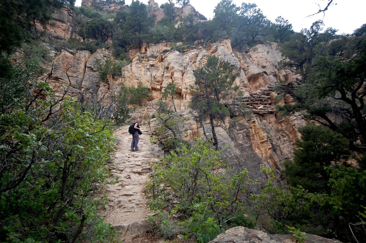
The Grandview Trail is pretty steep and exposed:


But there are great views along the way:


Almost there!


We made it!


And finally we can see the Colorado River:


And now it's time to make our way back...


It's getting tougher and tougher...


And at times some of us are close to giving up... ;)


But in the end we made it back up and it was well-worth the effort. The views both in macro and micro scale were awesome: