Showing posts with label SF. Show all posts

Tuesday, August 16, 2011

Lab Retreat Fun

At the end of May my lab went on a two-day lab retreat, which I organized pretty much single-handedly. I put a lot of effort into organizing it, so I was very happy to see that it went well and everybody enjoyed it.

The primary purpose of the lab retreat was to have in-depth discussions on selected few interesting topics in our area of research. The secondary purpose was to have a lot of fun. And a lot of fun we had :)

I was very happy (and proud) to see that all my labmates tried to make the lab retreat as entertaining as possible, and that they came up with many ingenious games even for the scientific part of the retreat. For example, one group created a game with similar mechanics to Magic: The Gathering based on theories of aging:

And to make it even more interesting, they traced the remaining life each player had on a lifespan graph:

I, on the other hand, organized an event called "Bio-Olympics". It included three activities: plate toss, rope pulling and building of a worm.

Plate toss. If you look carefully, you will see several agar plates up in the air:

Rope pulling:

My boss as a worm, and the rest of the lab behind her:

Lab on the rock:

In the evening we spent 2 hours playing science taboo:


And when we were done with it, we first played Mafia/Werewolf and then Jenga:

On the second day my awesome friend Nicole, who is an equally awesome personal coach, led a team building session for us. It was a highly valuable experience for us and we all loved it and truly appreciated Nicole's help. Thank you so much, Nicole!

Saturday, February 26, 2011

Chantey Singing at San Francisco Maritime National Historic Park

On the first Saturday of every month San Francisco Maritime National Historic Park organizes a public sing-along of sea chanteys and sailor songs aboard a historic ship "Balclutha". The event starts at 8 pm and lasts until midnight. It usually attracts around 150-200 people, most of whom seem to be "regulars".

Several of my friends and I took part in it a few Saturdays ago (on the first Saturday of February) and we had lots of fun even though we didn't know most of the songs. It was really cool to be on a ship at night together with a big group of people enthusiastic about sailing and sailor songs.

An added bonus was a hot cider and hot chocolate that were served for free on the ship, as well as amazing views of San Francisco.

The event is free and I would definitely recommend checking it out.

The entrance to Hyde Street Pier:

A view of Ghirardelli Square from the ship:

On the ship:

View of Financial District, Transamerica Pyramid and Coit Tower from the ship:

The park is located in the Fisherman’s Wharf neighborhood of San Francisco and the historic ships are anchored at Hyde Street Pier.

Tuesday, February 22, 2011

Montara Mountain via McNee Ranch

In the middle of January Anil and I went for a hike to the top of Montara Mountain, which provides spectacular views of San Francisco Bay Area.

The top of the mountain can be reached either via trails originating in San Pedro Valley County Park or in McNee Ranch State Park. The former we hiked in September 2010, and the latter will be described in this post.

The trailhead for the hike is located around 4 miles south of Pacifica, just after the Devil's Slide. There is a small parking lot with enough space for around 20-30 cars, which is located on the east side of the road. On weekends it fills up quickly, so I would recommend getting there before 10 am.

The trailhead elevation is around 100 ft, and the top of the mountain is at 1898 ft. This means 3800 ft of elevation change over 7.5 miles, which takes around 3-3.5h to hike (including a picnic at the top).

The hike is pretty strenuous and there are hardly any flatter parts. Luckily, views all along the way are very beautiful, so on the way up one can take many short breaks to enjoy them, without feeling guilty for pausing so often.

The last third of the hike utilizes the same fire road as the hikes originating in San Pedro Valley and the views from the top are exactly the same for both hikes. Compared to the San Pedro Valley hike, the McNee Ranch hike is more exposed and a bit more monotonous. Therefore, if you have time only for one of these hikes, I would recommend the hike starting in San Pedro Valley County Park over this one.


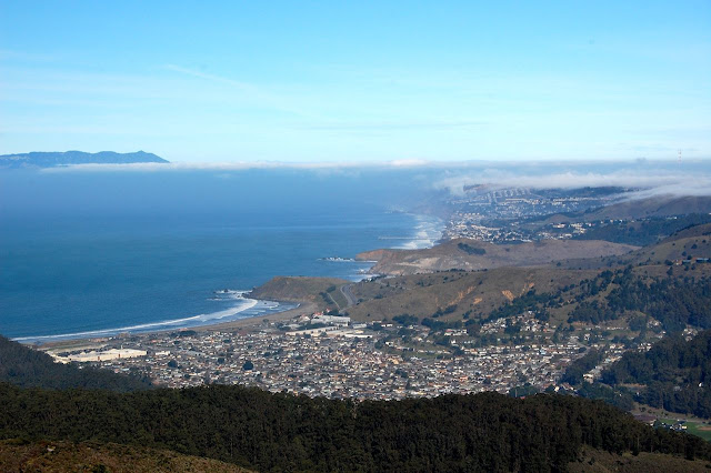
Montara Beach:


Pacifica and San Francisco:

The top of Montara Mountain:

Fire Road:

Devil's Slide:

Sunday, February 20, 2011

San Francisco by Night 2

I had a camera with me at work, so I took a few pictures on my way back home.

Conclusions:

(1) My new camera set up kicks ass!
(2) San Francisco is sooooo beautiful...
(3) UFOs exist (check out the sky on the picture number 5)
(4) I love my neighborhood and I feel extremely grateful for having a chance to see such extraordinarily fantastic views every single day.
(5) It seems that I almost always leave the city on the full moon... Hmm...


Wednesday, February 16, 2011

Breaking News - Matt Damon, Gwyneth Paltrow & Jude Law at My Work Today!

Matt Damon, Jude Law and Gwyneth Paltrow will be visiting my work today, as it will serve as a set for their newest movie Contagion. On that occasion our building got renamed to "Mendel Hall" :)

I feel motivated to stay longer at work, even though I'm sick... :) I just wished I had a camera with me...

Update: I have not seen anybody famous, but my coworkers have spotted Matt Damon and Jude Law. Apparently they were only involved in a short scene taking place inside one of the labs, and they came by inconspicuous cars. But in the movie there should be some other scenes as well featuring Genentech Hall and Bakar Gym, so if you watch it, you might recognize the following:

Genentech Hall - for the purpose of the movie renamed to "Mendel Hall":

One of the corridors in the Genentech Hall:

Extras waiting for their five seconds of fame:

Genentech Hall at night (I'm sure some of the scenes will take place outside, after sundown):

My gym - Bakar Center - was nicely lit tonight, which makes me think that it will also be used as a set for the movie:


Yet another potential target for the movie set:

At the very least you have to admit that my workplace is very photogenic :)

We (a group of around 6-7 people under the command of a French postdoc from my lab) tried to get to the closed set were the movie was shot by using one of the last year's Nobel Prize Laureates as a bait. Our attempts failed, as our Nobel Prize Winner shied away from completing the mission :)

Update part 2: I just learned that "Contagion" was also shot two blocks away from my house... I saw piles of trash here and there, and I was wondering what were they doing in my hood, but I just did not put things together...  

Tuesday, November 23, 2010

Dipsea Trail - Mill Valley to Stinson Beach

Last Saturday we hiked the full length of the Dipsea Trail, all the way from Mill Valley to Stinson Beach, and back.

Total distance hiked: 14.8 miles (23.82 km)
Elevation change: 9,276 feet (2,827 m)

As I realized after the hike, that's almost exactly the same distance and elevation change that one has to hike when going to the bottom of the Grand Canyon and back. The more proud I am to report that we completed the hike in 6h 30 min!

Since I did not find a good description of this hike anywhere in the internet, I am going to try to be as detailed in my description as possible.

The trailhead for the Dipsea Trail is located in Old Mill Park in Mill Valley, CA (for directions click here).

There are several (free) parking spots in the Old Mill Park along Cascade Drive. Try to park as close to the park entrance as possible, as the trailhead is located just opposite the entrance at the intersection of three roads: Cascade Drive, Cascade Way, and Molino. There are no obvious trail markings and it almost looks like the trail leads to somebody's house: take a look at Google Map street view. Don't get discouraged by that and aim for the staircase located in the driveway on the photo above.

The trail starts with three flights of stairs (adding up to 671 steps). According to the local legend, people who hiked and/or run Dipsea never die, they just reach the 672nd step :)

Once you walked up the first set of stairs, you will need to take a few steps to the right. The second set of stairs will be there. To find the third set, you will need to take a few steps to the left.

After the third set of steps you will find yourself on Sequoia Road. Follow the road (to the west/right) for around 600 ft (200 m), until you get to Walsh Drive. Continue on Walsh Drive and then Bay View until you reach Panoramic Highway. This is where you finally get off the pavement and where the good trail markings start.

The trail will continue on the other side of the highway, slightly to the right of the direction from which you came from. After around 5 minutes the trail will reach Muir Woods Road and will run parallel to it for around 0.4 mile (0.6 km). (In November 2010, this part of the trail was closed due to a mudslide. It's not a big deal, as you can walk on the road and rejoin the proper trail after 0.4 mile. To find the continuation of the Dipsea Trail, look for a sign "Cam Del Canon" and a few mailboxes on the left side of the road. It is so obvious that you can not miss it.)

Starting at Panoramic Highway the trail steadily drops down ~700 feet (210 m), until it reaches the lower parking lot of Muir Woods. From there, over the course of 2.2 miles (3.5 km), you will need to climb ~1400 feet (430 m), until you get to the top of "Cardiac Hill". As the name suggests, "Cardiac Hill" can make your heart start pumping pretty hard, but the views from there are absolutely fantastic and will fully compensate for your climbing efforts. On a clear day you will be able to see San Francisco, the Bay Bridge, Oakland, top of the Golden Gate Bridge, the Bay and the Pacific Ocean.

If you feel tired and did not arrange for anybody to pick you up at the end of the trail in Stinson Beach, this would be a good place to turn around, as from here over the course of next 3 miles (4.8 km), the trail will drop all the way down to the ocean, and you will loose all the elevation that you gained so far. But if you feel strong, I would definitely recommend going all the way to Stinson Beach, as this part of the hike is the prettiest. From now on, the trail will lead you through a deep misty forest across several Marin hills. Moreover, during the final one mile of the trail there are spectacular views of Stinson Beach and the ocean.

After reaching Stinson Beach you have a choice of either going back the same way you came (this is what we did last Saturday), or you can make your hike even longer by first hiking the Matt Davis & Steep Ravine Trails (described here and here) before rejoining the Dipsea Trail.

All in all this is a fantastic, but challenging hike. It crosses several parks: Mt. Tamalpais SP, Muir Woods NM, the Golden Gate Recreational Area, and it brings you all the way to the ocean and a nice beach. It should not be attempted by novice hikers (unless you do it one-way only). Depending on your strength, it can take you anything from 5 to 8 (or more) hours to complete it. Though there are people who run it in 2h...

For us, the first half of the hike (getting to Stinson Beach) was super-easy and fast, but hiking back from there was not. I started feeling pain in one of my knees at around mile 11 and, therefore, the last 4 miles where a bit unpleasant - especially during the downhills. Absolute killer for me was at the end of the hike when we had to walk down the 671 steps... Every single one of them was hurting.

At around mile 14, Anil renamed the hike "Dip-shit", which expresses pretty well what we felt at that particular moment... Still, we are very proud of ourselves for having finished it and we are surprised that today, a day later, nothing hurts us. I hope that it means that both of us are in a reasonably good shape before our Andean adventure.

The hike begins with 671 steps:

The second half of the trail leads through the beautiful green forest of Muir Woods NM:


The views from the top of Cardiac Hill:


Just a mile away from Stinson Beach:


And finally we reached the beach!

Saturday, August 7, 2010

Glass Buildings of San Francisco

During the architectural tour we got introduced to two famous glass buildings of San Francisco.

Hallidie Building, the first American building to feature glass curtain walls:


Crown-Zellerbach Building and reflection of Shell Headquarters: